Annual Geotechnical Hazard Monitoring: Scalable Surface Deformation Tracking
Executive Summary
Primary Objective: High-frequency surface movement tracking using a hybrid of GNSS-integrated Spike Monitoring and LiDAR change detection.
- Clients: Major Energy Infrastructure Operators (Pembina, TC Energy, Plains Midstream, ATCO)
- Location: Western and Central Canada
- Leaders: Andrew Healy, P.Eng., ALS, Elviss Laicans
Cost-Effective Monitoring of Large-Scale Hazards
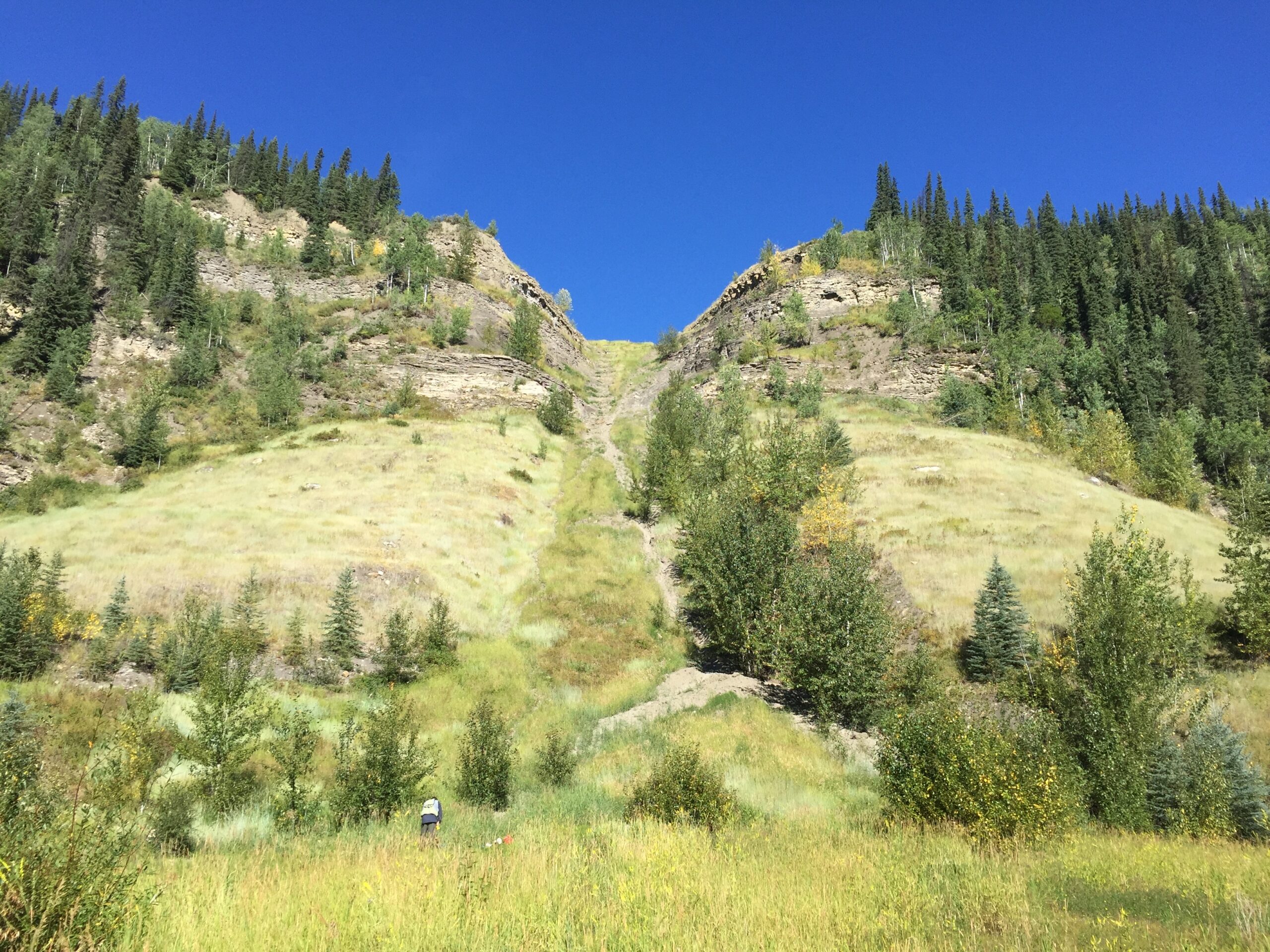
Managing linear assets across hundreds of active geohazards requires a balance between geodetic precision and economic scalability.
The Problem
Technical Constraints
Timeline Pressure
Hybrid Surface Monitoring & Technical Grit
MSI utilizes a proprietary “Spike Network” strategy to provide a comprehensive view of horizontal and vertical displacement across the entire hazard footprint.
Rigid Control Networks
To ensure absolute vector accuracy, MSI establishes six independent control bars per site, situated entirely outside the zone of movement. These serve as the fixed baseline for all longitudinal epoch comparisons.
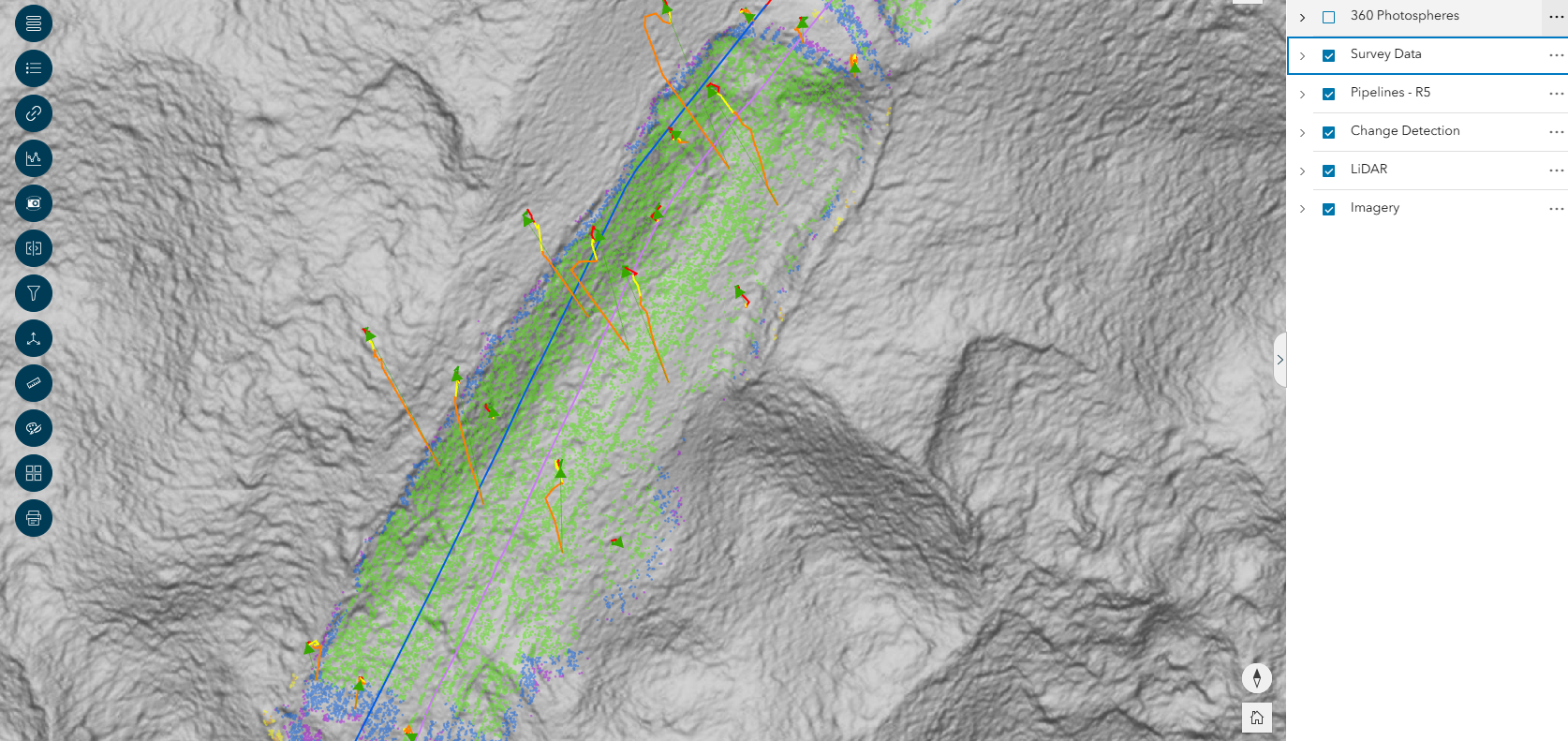
M3C2 LiDAR Analysis
To complement horizontal spike data, MSI utilizes a customized in-house M3C2 (Multiscale Model-to-Model Cloud Comparison) algorithm. This method accounts for complex slope geometry and surface roughness, providing point-to-point change detection with a Vertical RMSE of better than 5cm.
Subsurface Data Synthesis
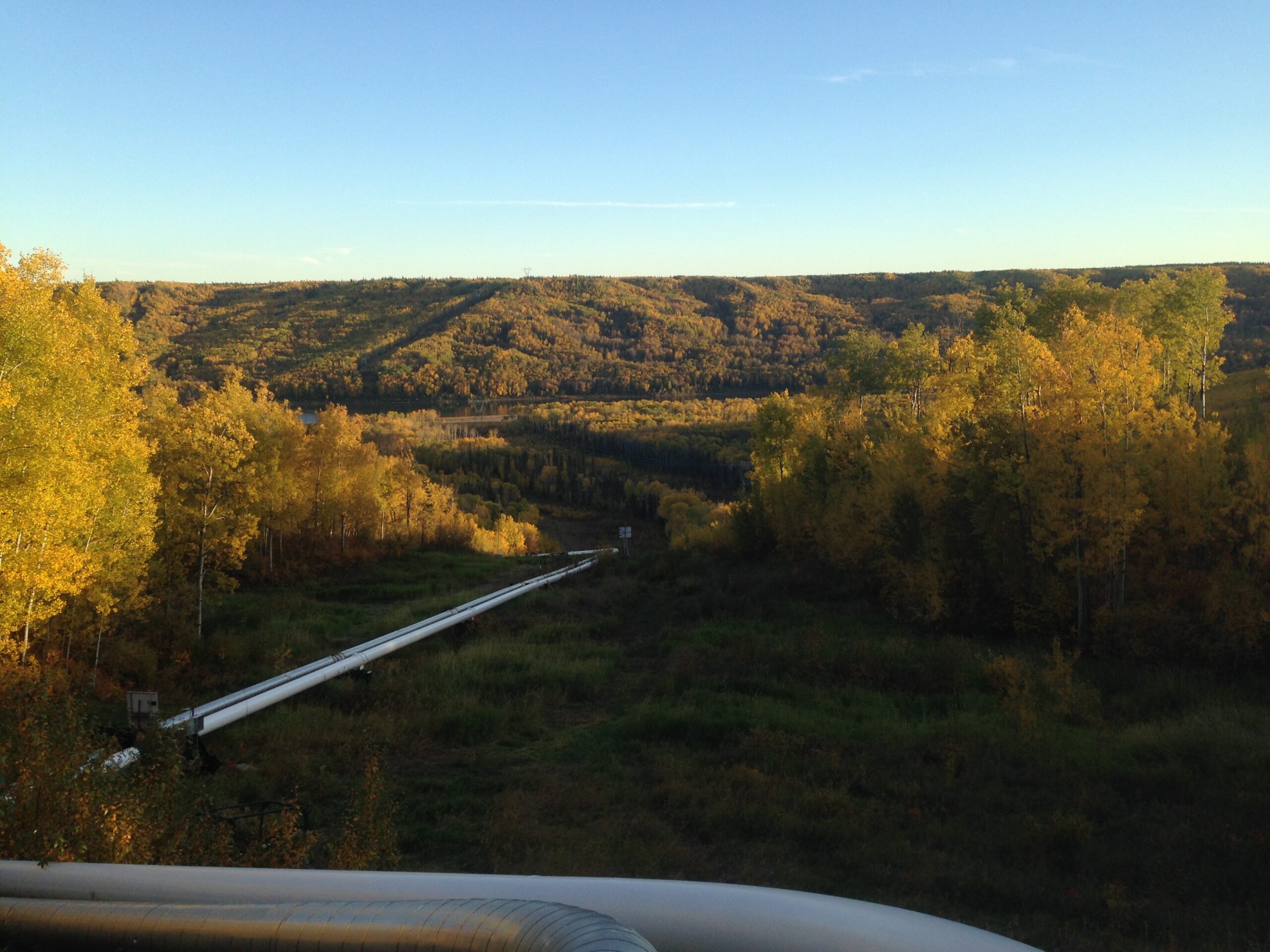
MSI bridges the gap between topographic surfaces and geotechnical engineering by performing CAD overlays of third-party subsurface reports. Inclinometer and Piezometer data are projected onto MSI’s profiles, allowing clients to see deep-seated movement in direct relation to surface spikes and current terrain.
Accountability & Data Performance
Massive Network Scale
MSI manages a regional network of over 10,000 spikes, providing the most extensive surface-monitoring dataset in Western Canada.
Actionable Reporting
Successfully identifies movements above 20mm, with emergent thresholds put in place.
Asset Integrity Support
By quantifying horizontal vectors and displacements, MSI provides the evidence-based data required for operators to plan stress-relief or remediation work before slope movement leads to structural failure.
Dynamic Escalation
Depending on client needs and observed movement acceleration, MSI scales monitoring frequency as needed.
Centralized Database
All results are integrated into the GeoView Monitoring Database, where starting in 2026, clients will have the ability to perform historical queries and search for specific spike displacements across years of data.
Geographic Reach: A North American Footprint
While our headquarters remains in Calgary, our operational reach has expanded alongside our technical capabilities. In 2005, we began by serving Alberta and British Columbia. Today, MSI is a cross-border geospatial partner with the proven ability to mobilize in diverse and extreme environments.
6921 48 St SE
Calgary, Alberta
T2C 5A4
+1 (403) 283-3773
© 2026 Measurement Sciences Inc. All rights reserved.