High-Precision Railway Infrastructure Monitoring: Calgary Transit Red Line LRT
Executive Summary
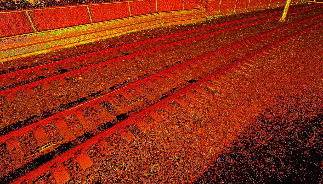
Primary Objective: High-precision automated monitoring of critical LRT rail infrastructure to detect deformation or settlement caused by adjacent multi-story building construction.
- Clients: Calgary Transit
- Location: Calgary Transit Red Line, Stampede Park (Victoria Park Station)
- Lead Engineer: Jesse Vanneste, P. Eng., ALS
Protecting High-Consequence Transit Infrastructure
The Calgary Transit Red Line is a vital piece of public transportation infrastructure. Construction of a multi-story building directly adjacent to the LRT right-of-way introduced significant risks to the track’s geometric stability.
The Problem
Rigid Tolerance Standards
Technical Constraints
High-Order Laser Scanning & Automated Analysis
Integrated Workflow:
MSI established a mobile office vehicle to process data while traveling. Processing commenced immediately post-flight, with teams working through the night to ensure stakeholders had actionable data by the next day.
Technical Precision:
Utilized a helicopter-mounted LiDAR sensor with terrain-following technology. This allowed the aircraft to maintain a constant altitude relative to the steep canyon walls, ensuring a uniform point density of 100+ pts/m2 on the bare earth surface.
Accountability & Data Performance

Mission Success:
Successfully executed 130 snow free epochs throughout the life span of the project.
Geometric Accuracy:
Achieved an average Vertical Root Mean Square Error (RMSE) of 3.8 cm
High-Resolution Visuals:
Delivered orthophotos at 4cm resolution, enabling remote visual inspection of rock bolts, mesh, and structural fatigue.
Change Detection:
Developed an interactive Change Detection Layer showing differences within +/- 10 cm between epochs, allowing for the immediate identification terrain movement or slide precursors.
Centralized Data Management:
Designed a comprehensive GIS web database to centralize all deliverables, providing a single "source of truth" for movement trends over the 32-month project lifespan.
Geographic Reach: A North American Footprint
While our headquarters remains in Calgary, our operational reach has expanded alongside our technical capabilities. In 2005, we began by serving Alberta and British Columbia. Today, MSI is a cross-border geospatial partner with the proven ability to mobilize in diverse and extreme environments.
6921 48 St SE
Calgary, Alberta
T2C 5A4
+1 (403) 283-3773
© 2026 Measurement Sciences Inc. All rights reserved.