MSI GeoView
MSI GeoView is our web-based GIS suite designed to transform complex geospatial data into accessible, actionable intelligence. We recognize that high-density LiDAR, bathymetry, and cadastral data are only as valuable as they are accessible. GeoView eliminates the need for specialized software or high-performance hardware, allowing stakeholders to visualize, analyze, and manage their assets through a secure, customizable interface.
Core Technical Capabilities
CorrView
Specialized web-GIS hosting for high-resolution imagery and corridor data, accessible regardless of geographical location.
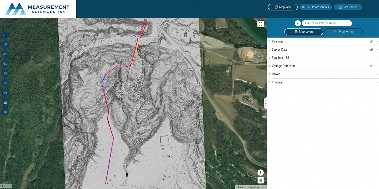
SiteView
Spatial layer database to show current and historical data of a specific location.
Seamless Data Accessibility
Rapid delivery of LiDAR point clouds, 3D models, and orthophotos to stakeholders without requiring specialized local computing resources.
Customizable GIS Environment
Tailored dashboards and layers designed to meet the specific monitoring needs of energy, utility, and municipal partners.
Interactive 3D Visualization
Real-time manipulation of underwater surfaces (Bathymetry) and terrain models (LiDAR) within a standard web browser.
The MSI Technical Edge
GeoView is built by surveyors and engineers for project managers and stakeholders. It bridges the gap between field acquisition and office-based decision support.
Full In-House Customization
Unlike "off-the-shelf" solutions, our GIS team collaborates directly with clients to build custom tools and workflows within the GeoView environment.
Platform Agnostic Access
Designed for use across various devices, ensuring that field crews and executives alike have access to the same "single source of truth."
Advanced Security:
Enterprise-grade hosting to protect sensitive infrastructure data and proprietary asset information.
Safety-First Operations
Remote sensing often requires mobilization in remote or hazardous areas. MSI operates under a COR-certified safety program, with field teams specifically trained in Bear Awareness, Snowmobile Safety, and Industrial Fall Protection. We maintain verified compliance with ISNetworld, Avetta, and ComplyWorks, and prioritize the use of autonomous UAVs and long-range aerial sensors to minimize ground-personnel exposure to high-risk environments like unstable slopes or active utility corridors.
6921 48 St SE
Calgary, Alberta
T2C 5A4
+1 (403) 283-3773
© 2026 Measurement Sciences Inc. All rights reserved.