Geomatics & Specialized Engineering
MSI was founded on the principles of high-precision deformation and engineering-grade geomatics. We specialize in complex measurement challenges where standard surveying techniques are insufficient. By combining advanced mathematical analysis with state-of-the-art instrumentation, our Geomatics Engineering team provides the technical foundation for North America’s most demanding infrastructure, industrial, and scientific projects.
Core Technical Capabilities
High-Precision Industrial Alignment
Specialized metrology for complex facilities, including particle accelerator alignment and turbine positioning.
Structural Deformation Analysis
Millimeter-level monitoring of dams, bridges, and high-value industrial assets to ensure structural health.
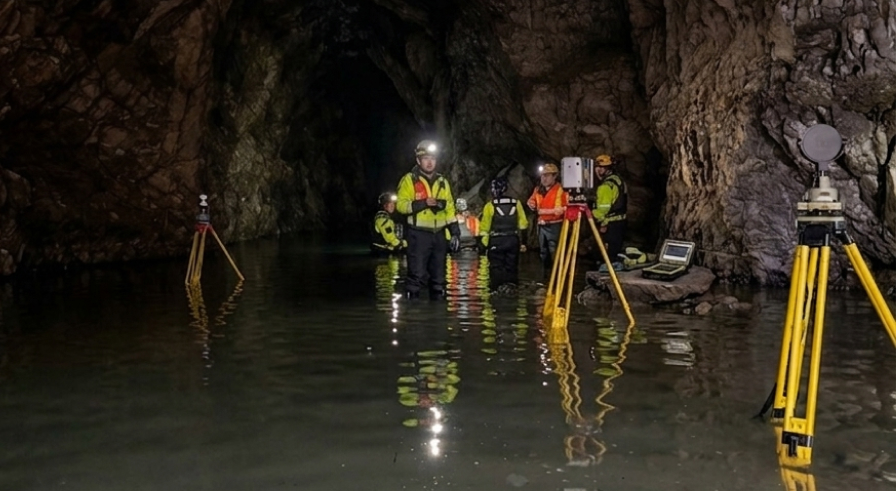
Inverted & Confined Space Scanning
Utilizing specialized LiDAR for “bottom-up” scans of bridges, penstocks, and tunnels.
Geodetic Control Networks
Establishing high-accuracy primary control for large-scale infrastructure and municipal developments.
The MSI Technical Edge
Our engineering services are led by P.Eng. and ALS professionals who specialize in geodesy and high-order measurements. We treat every project as a unique engineering problem, selecting the technology that matches the required tolerance:
Niche Environmental Access
Capability to perform scans in inverted or confined environments where traditional GPS or aerial sensors cannot operate.
Technical Continuity
Our founding focus on precision deformation ensures that we provide consistent, repeatable data across long-term monitoring campaigns.
Global Support Integration
Our engineering data is supported by internal GIS and drafting teams to provide rapid visualization of deformation trends and as-built deviations.
Safety-First Operations
Remote sensing often requires mobilization in remote or hazardous areas. MSI operates under a COR-certified safety program, with field teams specifically trained in Bear Awareness, Snowmobile Safety, and Industrial Fall Protection. We maintain verified compliance with ISNetworld, Avetta, and ComplyWorks, and prioritize the use of autonomous UAVs and long-range aerial sensors to minimize ground-personnel exposure to high-risk environments like unstable slopes or active utility corridors.
6921 48 St SE
Calgary, Alberta
T2C 5A4
+1 (403) 283-3773
© 2026 Measurement Sciences Inc. All rights reserved.