Jasper Wildfire Complex: Rapid Response & Post-Disaster Damage Assessment
Executive Summary
Primary Objective: High-resolution aerial mapping and pipe locating for immediate right of way and damage assessment and geohazard mitigation following the 2024 wildfire event.
- Clients: ATCO and Phasor
- Location: Jasper, Alberta
- Duration: August 2024
- Leaders: AAndrew Healy P.Eng. Elviss Laicans, Matthew Glanzer P.Eng.

Complexity & Evolving Mandates
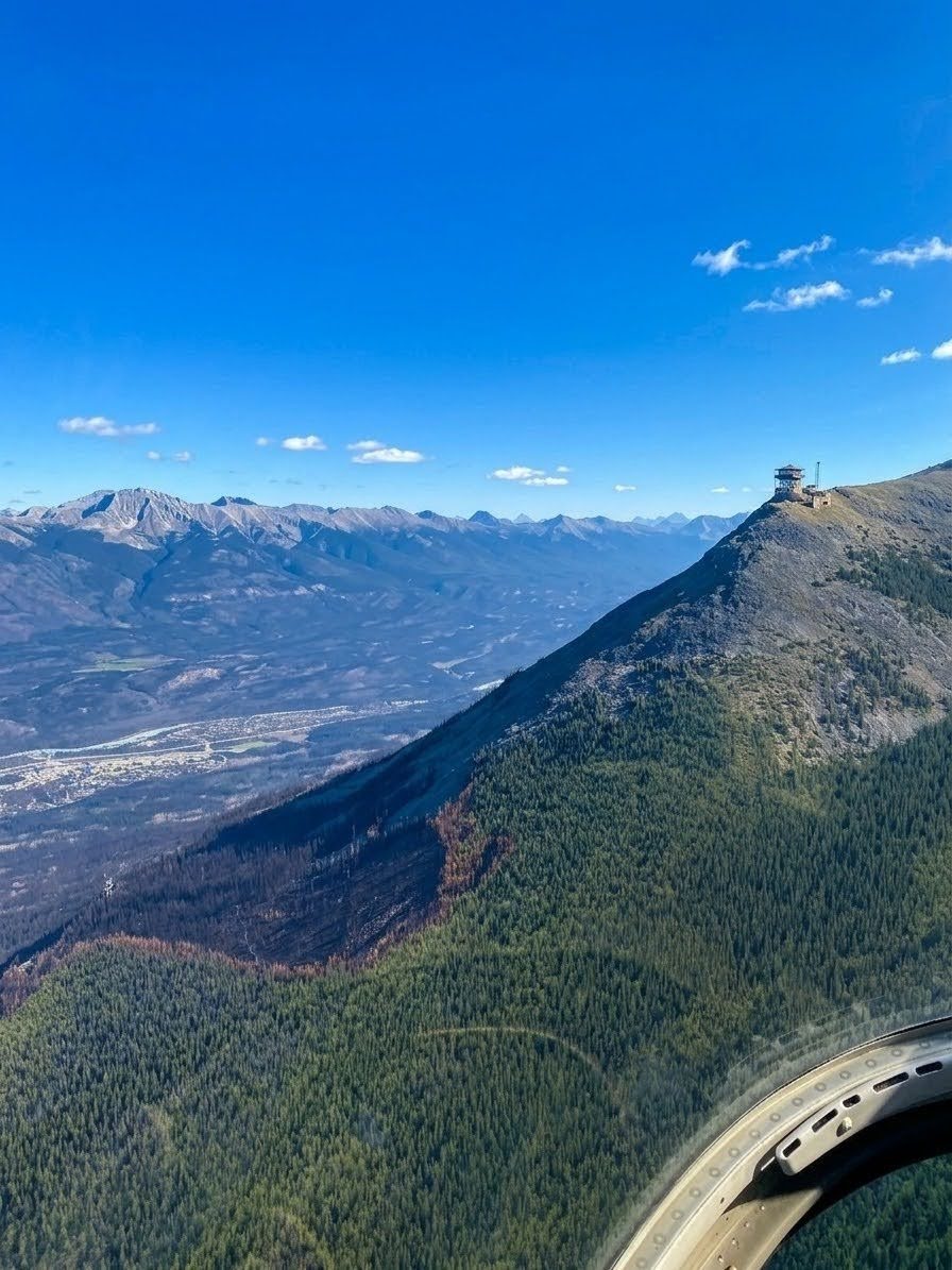
Following the July 2024 wildfire breach of the Jasper townsite, stakeholders mobilized an immediate infrastructure recovery mission to restore essential services. This response prioritized a 25km emergency pipeline inspection to verify depth of cover and right-of-way condition, ensuring the safe delivery of resources back to the community. Simultaneously, an expedited LiDAR mission was deployed to address the compromised power supply to the Jasper Tramway; this survey captured slope and wire data, providing the critical technical groundwork required to design and implement a new, secure power route.
The Problem
Ground-Level Obstacles
Technical Constraints
Precision Requirements
Timeline Pressure
An Extension of Your Team
MSI deployed a rapid-response aerial unit that functioned as a primary visual and geodetic intelligence source for the recovery task force.
Field Grit
Survey teams manually navigated the 25km pipeline corridor, clearing debris and managing the hazards of fallen trees to ensure every geodetic point was captured accurately despite the terrain.
Technical Precision
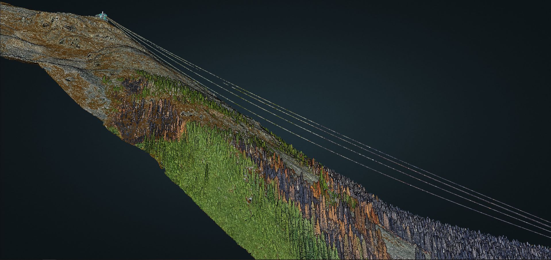
The helicopter-mounted VUX-240 ensured that the aerial point cloud was dense enough to supplement ground efforts, identifying the 2-inch powerline and providing a "bare earth" model of the charred landscape.
Integrated Workflow
Functioning as a technical extension of ATCO and the Jasper Tramway, MSI coordinated air and ground logistics to capture the entire ROW corridor in a single mobilization window.
Data Hosting
ROW condition data was integrated into GeoView, allowing stakeholders to view the visual state of the corridor alongside the geodetic data.
Accountability & Data Performance
Linear Infrastructure Recovery
Successfully located and verified 25km of ATCO pipeline, navigating extreme ground obstacles and downed timber to confirm asset integrity.
Precision Engineering
Located the 2-inch diameter powerline for the Jasper Tramway, providing the foundational data for the immediate re-routing of the system.
Response Reliability
Met the 24-hour mobilization mandate, ensuring that pipeline integrity assessments were not delayed by geomatics logistics.
Deliverable Cycle
Maintained a one-week turnaround for all processed LiDAR and ROW deliverables, despite the physical complexity of the ground-truth operations.
Geographic Reach: A North American Footprint
While our headquarters remains in Calgary, our operational reach has expanded alongside our technical capabilities. In 2005, we began by serving Alberta and British Columbia. Today, MSI is a cross-border geospatial partner with the proven ability to mobilize in diverse and extreme environments.
6921 48 St SE
Calgary, Alberta
T2C 5A4
+1 (403) 283-3773
© 2026 Measurement Sciences Inc. All rights reserved.