High Density LiDAR
High-Resolution Remote Sensing & LiDAR Solutions
MSI delivers advanced remote sensing projects across Canada, providing high-precision data acquisition at any scale. We move beyond raw data collection by acting as a strategic partner, selecting the optimal platform—fixed-wing, helicopter, UAV, or mobile mapping—based on project scale, required detail, and budgetary parameters. Our workflow is supported by a global drafting team, ensuring rapid turnaround and the delivery of actionable data when it is needed most.
Core Technical Capabilities
High-Density Measurement
Close-range acquisition at 50–100+ points/m² and 3–4cm imagery for resolving fine surface features.
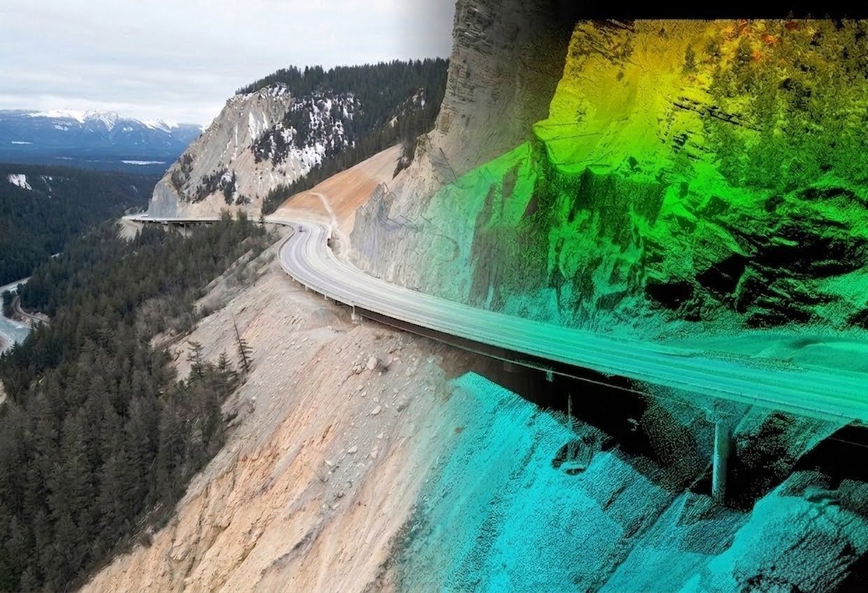
Geotechnical & Hazard Monitoring
Monitoring movement and hazards for sub-surface and above-ground assets.
Corridor & Mobile Mapping
Comprehensive surveys for energy transmission, distribution, and transportation infrastructure.
Topographic Supplementation
Utilizing aerial data to fill gaps and enhance traditional ground-based topographic surveys.
Forestry & Environmental Management
Specialized mapping for timber inventory and natural resource health assessments.
Dam Safety Reviews
Delivering high-resolution terrain models specifically for regulatory reporting and integrity analysis.
Disaster & Emergency Response
Rapid-mobilization surveys for flood, fire, and geotechnical emergency support.
The MSI Technical Edge
Led by P.Eng. and ALS professionals, our remote sensing division utilizes a fleet of five specialized sensors. We leverage industry-leading hardware to ensure precision in the most demanding environments:
Elite Sensor Suite
State-of-the-art systems including the Riegl Vux-240, Vux-1, and Mini-Vux, as well as the Teledyne Optech Galaxy and PhaseOne cameras.
Multi-Modal Acquisition
Simultaneous or independent capture via fixed-wing, helicopter, specialized UAVs, and terrestrial scanners.
Data Hosting (MSI GeoView)
Dissemination via our customized web-GIS environment, providing stakeholders with high-performance visualization without the need for specialized local hardware.
Safety-First Operations
Remote sensing often requires mobilization in remote or hazardous areas. MSI operates under a COR-certified safety program, with field teams specifically trained in Bear Awareness, Snowmobile Safety, and Industrial Fall Protection. We maintain verified compliance with ISNetworld, Avetta, and ComplyWorks, and prioritize the use of autonomous UAVs and long-range aerial sensors to minimize ground-personnel exposure to high-risk environments like unstable slopes or active utility corridors.
Accurate Datasets for any Project
Projects include geotechnical hazard change detection, assessments of hydro-electric dam facilities and highway as-builts.
UAV or Manual Aircraft
Multiple aquisition platforms allow MSI to accommodate virtually any project size and specification
1-100+ pulses/m2
From area mapping to precision measurement, MSI can provide customized data sets.
Up to 5cm RMSE
Precision ground control surveys and accuracy verification can accompany any project.
6921 48 St SE
Calgary, Alberta
T2C 5A4
+1 (403) 283-3773
© 2026 Measurement Sciences Inc. All rights reserved.