Bathymetric Surveying
Bathymetry & Hydrographic Surveying
MSI provides industry-leading bathymetric services across North America, specializing in high-resolution mapping of riverbeds, lakes, and industrial water infrastructure. With a track record of over 2,000 completed hydrographic surveys, we combine decade-long experience with state-of-the-art sonar technology to deliver precise underwater surfaces. Whether for regulatory dam safety reviews or critical pipeline integrity inspections, our ability to map complex sub-surface environments is unmatched in the region.
Core Technical Capabilities
Single & Multibeam Bathymetry
High-density 3D underwater surface modeling for detailed terrain and asset visualization.
Riverbed Change Detection
Longitudinal monitoring to track scour, sediment transport, and bed degradation, particularly after high-flow events.
Sub-Bottom Profiling
Identifying sub-surface layers and buried assets beneath the waterbed.
Side Scan Sonar Imaging
High-resolution acoustic imaging for obstacle identification and debris mapping.
Dam Safety & Intake Investigations
Specialized inspections for hydroelectric and municipal water infrastructure.
Dredge Volume Calculations
Accurate pre- and post-dredge surveys for industrial and construction applications.
The MSI Technical Edge
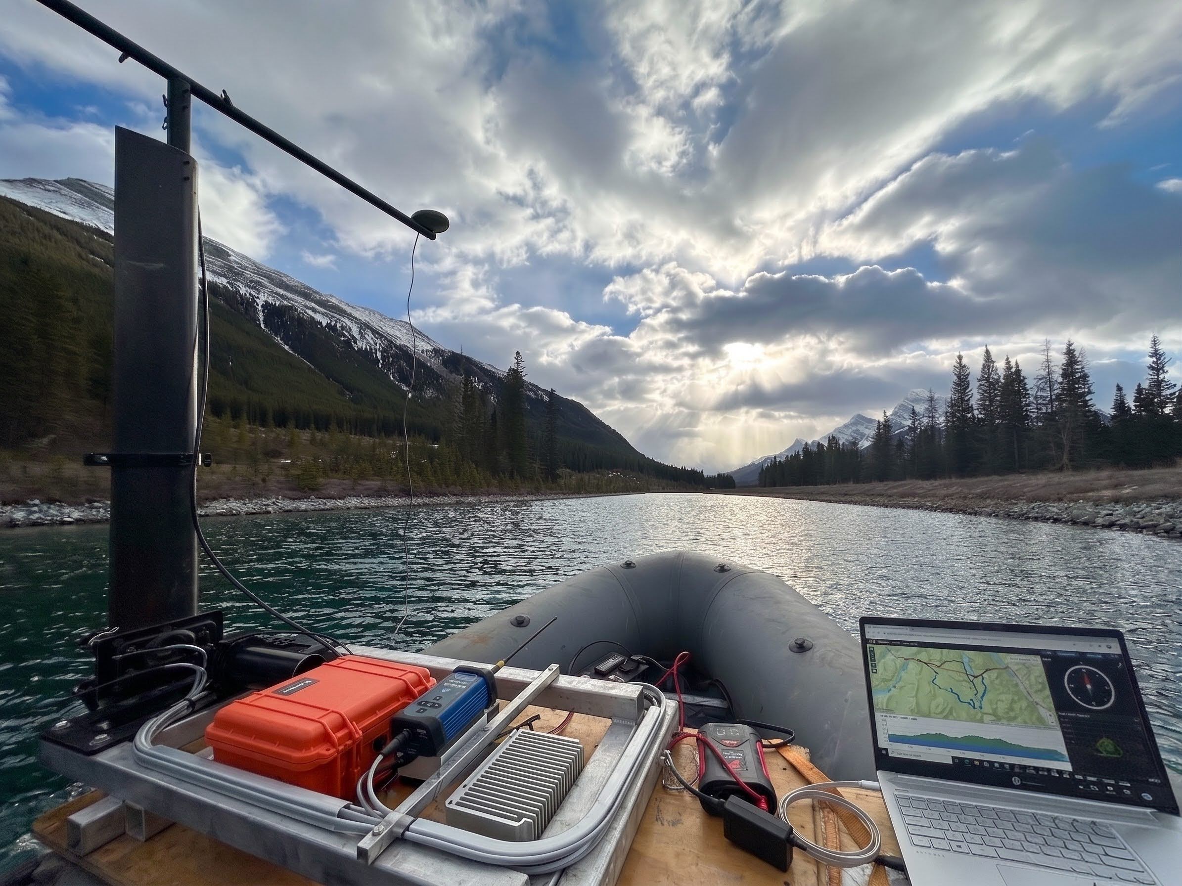
We operate a specialized fleet of watercraft and sensors designed to navigate any watercourse, from shallow storm ponds to high-flow mountain rivers.
Autonomous USV Operations
We utilize the Roboboat Unmanned Surface Vessel (USV) to perform surveys in hazardous or inaccessible waters, significantly increasing data density while removing personnel from risk.
Advanced Echosounders
Utilization of Norbit Multibeam systems and dual-frequency sounders to capture precise data in varying depths and turbidities.
Seamless Above-and-Below Modeling:
By integrating Bathymetric data with aerial LiDAR, we provide a continuous 3D model across the water-land interface.
Interactive Deliverables
Beyond traditional topographic maps, we provide interactive 3D models and GIS-ready surfaces via our CorrView hosting platform.
Safety-First Operations
Remote sensing often requires mobilization in remote or hazardous areas. MSI operates under a COR-certified safety program, with field teams specifically trained in Bear Awareness, Snowmobile Safety, and Industrial Fall Protection. We maintain verified compliance with ISNetworld, Avetta, and ComplyWorks, and prioritize the use of autonomous UAVs and long-range aerial sensors to minimize ground-personnel exposure to high-risk environments like unstable slopes or active utility corridors.
6921 48 St SE
Calgary, Alberta
T2C 5A4
+1 (403) 283-3773
© 2026 Measurement Sciences Inc. All rights reserved.