Movement Monitoring
Precision Movement & Deformation Monitoring
MSI specializes in the design, implementation, and analysis of sophisticated movement monitoring systems. Built on our foundational expertise in high-precision engineering, we provide the rigorous measurement techniques required to monitor the stability of critical infrastructure and natural landscapes. From geotechnical hazard evaluation to structural deformation tracking, we deliver the high-fidelity data necessary to mitigate risk and ensure long-term asset integrity.
Core Technical Capabilities
Real-Time Deformation Monitoring
Automated systems providing continuous tracking of structural or ground movement.
Geotechnical Hazard Evaluation
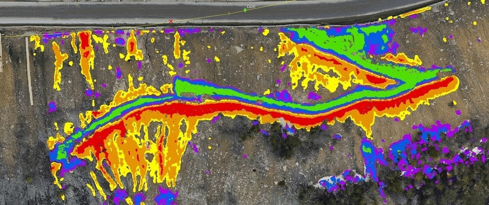
Utilizing high density LiDAR and conventional spike monitoring to monitor slope integrity, riverbank stability, and subsidence.
Structural deformation
Precise horizontal and vertical surveys for dams, bridges, penstocks, and industrial facilities.
Remote Sensing Integration
Leveraging high density LiDAR change detection to identify subtle topographical shifts over large areas.
Spike Monitoring
Specialized systems designed for high-frequency movement detection in sensitive environments.
Volumetric Analysis
Tracking changes in earthworks or stockpiles to monitor settlement or erosion over time.
The MSI Technical Edge
Monitoring methodology is customized to the scope and precision requirements of each project. MSI utilizes a multi-sensor approach overseen by P.Eng. and ALS professionals to ensure data meets engineering-grade standards:
Specialized Instrumentation
High-precision total stations, digital levels, and GNSS systems integrated with customized geotechnical sensors.
Autonomous Acquisition
Deployment of UAV-based LiDAR and terrestrial scanners for sites where physical access is dangerous or would disrupt operations.
Advanced Processing
Sophisticated post-survey analysis and visualization, including the ability to host real-time data via our customized web GIS environment.
Expertise in Complexity
Leveraging 20 years of experience in solving unique high-precision measurement challenges ranging from structure deformation to particle accelerator alignment.
Safety-First Operations
Remote sensing often requires mobilization in remote or hazardous areas. MSI operates under a COR-certified safety program, with field teams specifically trained in Bear Awareness, Snowmobile Safety, and Industrial Fall Protection. We maintain verified compliance with ISNetworld, Avetta, and ComplyWorks, and prioritize the use of autonomous UAVs and long-range aerial sensors to minimize ground-personnel exposure to high-risk environments like unstable slopes or active utility corridors.
6921 48 St SE
Calgary, Alberta
T2C 5A4
+1 (403) 283-3773
© 2026 Measurement Sciences Inc. All rights reserved.