Full-Reservoir Bathymetric & LiDAR Inventory: Barrier Lake, Kananaskis
Executive Summary
Primary Objective: To deliver the first high-density “Digital Twin” of the reservoir, providing an unprecedented view of the submerged terrain and surrounding topography.
- Clients: TransAlta
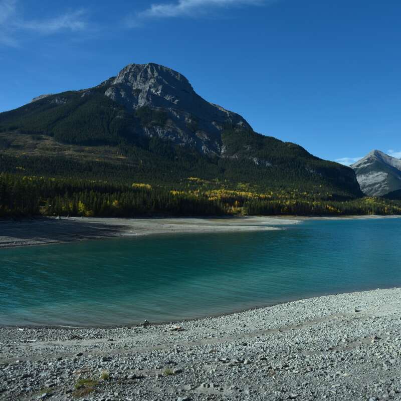
- Location: Barrier Lake, Kananaskis Country, Alberta
- Leaders: Andrew Healy, P.Eng., ALS
Mapping the Invisible History of the Basin
Prior to this project, TransAlta had never surveyed Barrier Lake at a density high enough to truly understand the topography and detail of the reservoir bed.
The Problem
Technical Constraints
Complex Morphology
Acoustic Precision & LiDAR Fusion
MSI deployed a multi-sensor strategy to capture every detail of the development and the surrounding wilderness.
High-Density Multibeam Mapping
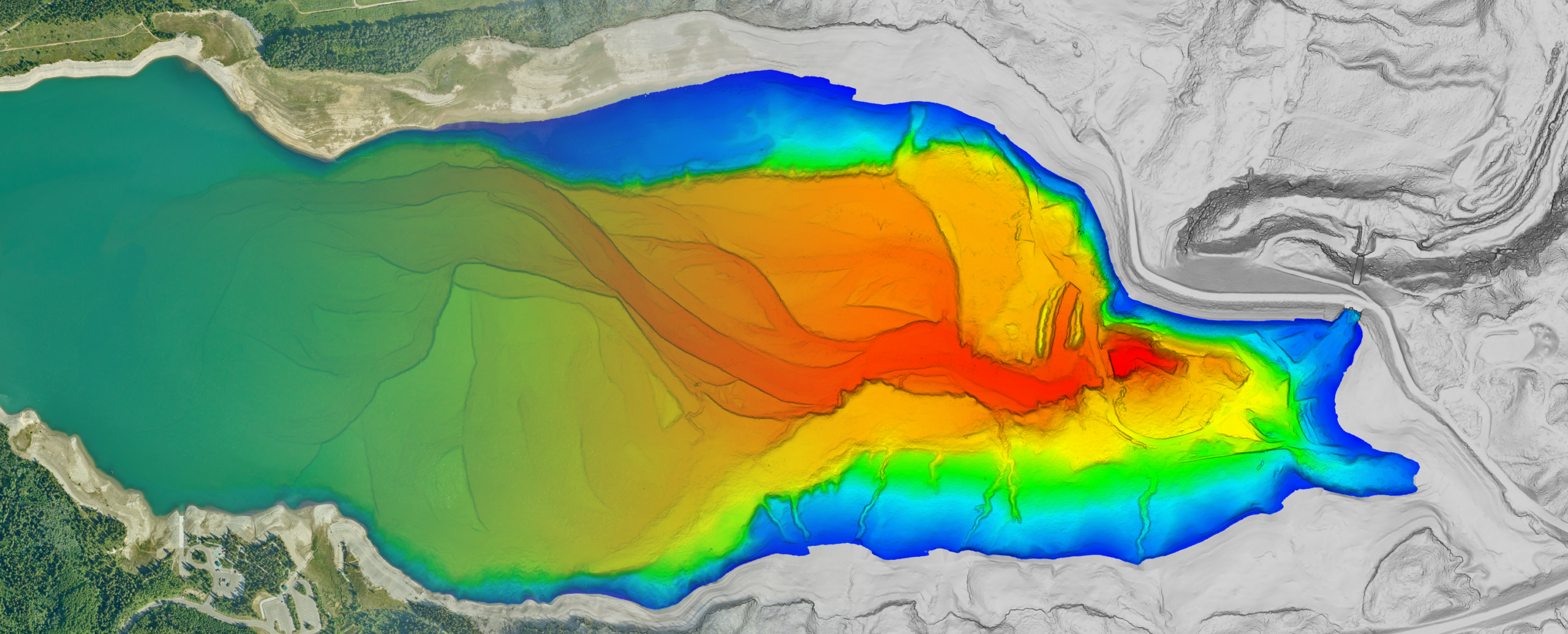
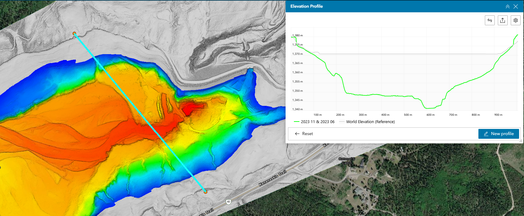
MSI utilized wide-swath multibeam technology to provide the first high-resolution look at the reservoir bottom. This revealed the original Kananaskis River channel, providing TransAlta with a clear visual of historical watercourses now submerged beneath 30m of water.
Full-Scale LiDAR Integration
While the sonar mapped the depths, MSI conducted a high density LiDAR survey of the surrounding area. This provided a high-precision 3D model of the dam infrastructure, access roads, and steep mountain slopes surrounding the reservoir.
Digital Twin
MSI’s GIS team merged the echosounding point clouds with the aerial LiDAR data, creating a seamless "bank-to-bank" model where the terrestrial terrain flows perfectly into the underwater bed.
A New Baseline for Asset Management
Discovery of Submerged Features
Successfully mapped the original Kananaskis River channel and identified previously unknown bottom features, giving TransAlta a new level of insight into their reservoir's history and health.
Comprehensive 3D Development Model
Provided a unified dataset of the entire area, allowing for future engineering simulations, environmental monitoring, and site safety planning.
Geographic Reach: A North American Footprint
While our headquarters remains in Calgary, our operational reach has expanded alongside our technical capabilities. In 2005, we began by serving Alberta and British Columbia. Today, MSI is a cross-border geospatial partner with the proven ability to mobilize in diverse and extreme environments.
6921 48 St SE
Calgary, Alberta
T2C 5A4
+1 (403) 283-3773
© 2026 Measurement Sciences Inc. All rights reserved.